
Masai Mara Road Conditions and Which Gate to Use
Separate highway, approach road, final camp track and wildlife roads, then match the exact property to a current gate and daylight route.
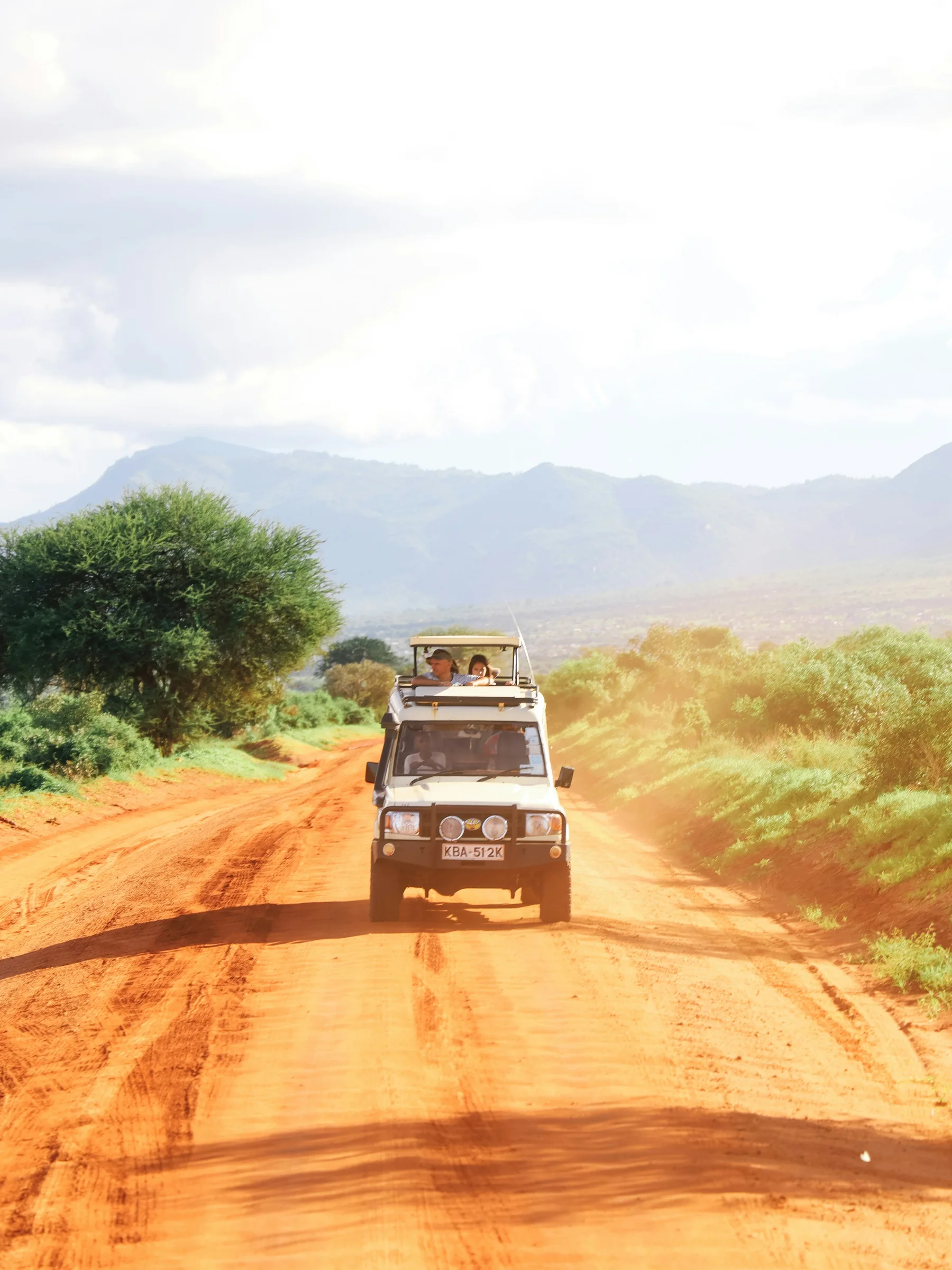
- The Masai Mara road question is really four questions
- First, identify the highway section
- Second, identify the approach road
- Third, identify the camp’s final access
- Fourth, identify the wildlife track network
- A four-part route table
- Start with the camp, not the gate name
- Ask for a dropped map pin
- Confirm the land unit
- Confirm whether the camp is inside or outside a gate
- Confirm the side of the river
- Confirm the permitted entry point
- Confirm the gate’s operating status
- Confirm the final escort arrangement
- The gate decision in one table
- Sekenani Gate
- When Sekenani often makes sense
- When Sekenani can add unnecessary driving
- What to ask before using Sekenani
- Talek Gate
- When Talek often makes sense
- Talek is an area as well as a gate reference
- Talek after rain
- Musiara Gate
- When Musiara often makes sense
- The Musiara landscape affects the drive
- Ask about bridges, not only roads
- Oloolaimutia Gate
- Spellings can vary
- Confirm whether you need to enter at all
- Oloololo Gate
- When Oloololo often makes sense
- The escarpment changes the feel of the approach
- Oloololo is not Purungat
- Purungat Gate
- When Purungat enters the plan
- Crossing the Triangle takes real time
- Sand River Gate
- The international boundary is not an ordinary shortcut
- Enoompuai and smaller access points
- Conservancy gates are property-specific
- Mara North access
- Naboisho access
- A gate is not just a point on a map
- Nairobi to Narok
- Leave with daylight to spare
- Nairobi traffic belongs in the calculation
- Narok is the last major planning point
- Stops change the arrival time
- Map time is not safari time
- Narok to the eastern approaches
- Narok to the northern and western approaches
- Aitong as a route reference
- The western approach to the Triangle
- Road-route comparison
- Dry does not always mean smooth
- Dust reduces visibility
- Corrugations punish speed
- Loose edges are not overtaking lanes
- Rain changes the weakest section first
- Black-cotton soil
- Four-wheel drive helps, but it is not magic
- Standing water hides the road
- Flowing water is a different hazard
- After the storm
- Flooding deserves its own plan
- April and May need honest margins
- Wet-road decision table
- When to choose a fly-in instead
- Fly-in suits a short safari
- Road suits a wider circuit
- Road can suit families
- Flying can suit travellers with mobility or back concerns
- A road-versus-flight table
- Self-drive or driven safari
- Self-driving requires more than confidence
- Rental category names can mislead
- One spare may not be enough peace of mind
- Recovery equipment needs knowledge
- Offline maps are essential
- Paper notes still matter
- Mobile coverage is uneven
- Fuel planning
- Do not drive at night
- Plan a latest departure time
- Driver fatigue is a route condition
- Self-drive readiness table
- What travellers remember about the road
- “The road from Nairobi to the Masai Mara is terrifying.”
- “maps are limited”
- “be prepared to turn back”
- “the last 75km is bumby gravel road”
- “slip slide traps”
- “the 4X4 was essential”
- “road Nakuru to Mara is awful”
- “couldn’t have driven ourselves”
- Personal accounts should not become promises
- How to read a road review
- Inside the reserve, the road belongs to wildlife
- Do not crowd a sighting
- Do not create a new track
- Closed means closed
- Speed belongs to the setting
- Give animals the exit
- Respect working communities on approach roads
- Photography from the road
- Game drives are not transfers
- Internal-road behaviour table
- A practical pre-departure call
- Ask what changed, not whether it is fine
- Ask who drove it last
- Ask for the alternative route
- Ask about gate payment and proof
- Ask about arrival after the gate
- Ask about a rendezvous
- Ask about luggage protection
- Ask about passengers
- A message you can send your camp
- Camp-confirmation checklist
- Vehicle preparation before Nairobi
- Tyres carry the route
- Clearance protects more than the bumper
- Wipers matter in dust and rain
- Lights are for visibility, not a night plan
- Keep weight secure
- Keep essentials accessible
- Protect the cabin from dust
- Vehicle-preparation table
- Packing for the drive
- Water without waste
- Food and wildlife do not mix
- Medication belongs with the passenger
- Motion sensitivity
- Children need a road day designed for them
- Accessibility needs exact answers
- The arrival day should stay light
- What not to pack loose
- The night before departure
- Route-choice examples
- Example: eastern reserve camp
- Example: Talek-area camp
- Example: Musiara camp
- Example: western Triangle property
- Example: reserve to Triangle split stay
- Example: conservancy stay
- Example: heavy rain before arrival
- Example: late flight arrival in Nairobi
- Example: short two-night safari
- Example: Naivasha to the Mara
- Route examples compared
- If the route goes wrong
- If the pin and sign disagree
- If you lose signal
- If you are late
- If rain begins hard
- If another driver says it is passable
- If you become stuck
- If wildlife blocks the road
- If a gate appears closed
- If the bridge is out
- Incident response table
- Frequently asked road questions
- Is the road from Nairobi to the Masai Mara paved?
- How long does Nairobi to the Mara take?
- Which is the main Masai Mara gate?
- Which gate is best for the Mara Triangle?
- Can I enter at one gate and leave at another?
- Do I need a four-wheel-drive vehicle?
- Can a two-wheel-drive car reach the Mara?
- Is self-driving allowed?
- What happens after rain?
- Should I fly during the rainy season?
- Is the road safe at night?
- Can Google Maps choose the gate?
- Is Purungat an external arrival gate?
- Can I drive directly from the Mara to the Serengeti?
- How close should I follow another safari vehicle?
- What should I do if the camp changes the route?
- What is the best source for current conditions?
- A better Mara arrival
- Let the landscape arrive gradually
- Keep the first game drive honest
- Build one route, one alternative and one stop point
- Match every camp to its gate before payment
- Match every transfer to the day’s purpose
- Final gate and road checklist
The last town slips behind you, the tarmac narrows into the distance and the Mara begins to feel close. Then the route on the screen forks. One road points towards Sekenani, another towards Talek, while your camp name appears somewhere beyond a pale web of tracks. This is the moment when a simple question becomes important: which gate should you actually use?
The answer is not automatically Sekenani. The right gate depends on the exact camp coordinates, the side of the ecosystem where you are staying, your starting point, the permitted route and the condition of the final approach that day. Two camps both described as “Masai Mara” can require very different drives.
This guide to Masai Mara road conditions and which gate to use separates the journey into the parts that matter. It explains the highway to Narok, the approach roads, camp access, reserve tracks, the principal gates and the conditions that can turn a sensible route into a poor one after rain. It is written for travellers planning a chauffeured safari as well as experienced visitors considering a self-drive.
The Masai Mara road question is really four questions
“How is the road to the Mara?” sounds like one question, but it hides four different surfaces. You may have a comfortable highway for most of the day, a rough approach after Narok, a short black-cotton section near camp and then slow wildlife tracks inside the reserve. A single adjective such as good or bad cannot describe the whole journey.
First, identify the highway section
Most road safaris from Nairobi travel west towards Narok before branching towards the Mara ecosystem. This is the transport part of the journey. Traffic, roadworks, town congestion, rest stops and the time you leave Nairobi can matter as much as the distance shown on a map.
Second, identify the approach road
The approach begins where the ordinary inter-town journey gives way to roads serving gates, settlements, conservancies and camps. This is where recent grading, corrugation, dust, standing water and rain damage make online journey estimates unreliable.
Third, identify the camp’s final access
A camp may be several kilometres beyond the nearest public road. Its last access can cross community land, conservancy tracks, a seasonal stream or sticky soil. A route can be manageable until this final section, which is why the camp's own dated advice matters.
Fourth, identify the wildlife track network
Once inside the reserve or conservancy, travel is no longer simply about reaching a destination. Tracks follow rivers, plains and approved routes. Animals have priority, speed is restricted and some routes may close to protect soil or wildlife.
A four-part route table
| Journey part | What normally changes it | Best source close to travel | Mistake to avoid |
|---|---|---|---|
| Nairobi to Narok | Departure time, traffic, roadworks and stops | Driver and current traffic information | Treating map time as a promise |
| Narok to the chosen gate | Grading, rain, dust and traffic | Camp, guide or land manager | Asking only whether “the Mara road” is good |
| Gate to camp | Camp location, permit and local track condition | The exact property | Following a pin without confirming access |
| Tracks inside the ecosystem | Weather, closures, wildlife and rules | Ranger, guide and land manager | Assuming every visible track is open |
Start with the camp, not the gate name
Find the exact property, not only its marketing description. “Near the Masai Mara” might mean inside the national reserve, inside the Mara Triangle, on private land near a gate or in a conservancy with its own access and rules. The gate follows that location.
Ask for a dropped map pin
Camp names can be similar and seasonal camps can move. Request a current dropped pin plus written arrival instructions. If you are self-driving, ask whether the pin marks reception, the gate, a rendezvous point or the tents themselves.
Confirm the land unit
The Masai Mara ecosystem includes the national reserve, the Mara Triangle and many community conservancies. Entry systems and access agreements are not interchangeable. Read the Masai Mara safari guide before choosing a route.
Confirm whether the camp is inside or outside a gate
A property outside the reserve can still use reserve gates for game drives. That does not mean guests should drive through that gate to reach the property. Arrival access and daily wildlife access may be two different routes.
Confirm the side of the river
The Mara and Talek rivers shape the road network. A camp that looks close across water may require a bridge or a long detour. Never assume a thin line on a map represents a usable crossing.
Confirm the permitted entry point
Your booking, voucher or conservancy arrangement may specify where to enter. A geographically convenient gate can still be wrong for the permit or property. The written itinerary should state this before departure.
Confirm the gate’s operating status
Gate use, hours and payment arrangements can change. Sand River and smaller entry points deserve specific confirmation. Do not build an arrival around an unverified gate simply because it appears on an old map.
Confirm the final escort arrangement
Some properties meet self-drivers or transfer guests from a known point. Record the contact name, telephone number and latest safe arrival time. Download the pin and instructions before mobile coverage weakens.
The gate decision in one table
| If your accommodation is mainly in this area | Gate or route usually discussed | What must still be confirmed |
|---|---|---|
| Eastern reserve and Sekenani area | Sekenani | Exact camp position, current approach and entry permit |
| Talek and central-eastern reserve | Talek | Which side of the Talek River, bridge access and camp directions |
| Southeastern reserve | Oloolaimutia or Sekenani, depending on property | The property's preferred approach and current road |
| Musiara and northwestern reserve | Musiara | Northern approach, river crossings and camp rendezvous |
| Western Mara Triangle | Oloololo | Aitong approach, escarpment access and property instructions |
| Central Triangle from the reserve side | Purungat connection | Whether the crossing is part of the approved itinerary |
| Mara North or another conservancy | Conservancy-specific access | Conservancy gate, booking proof and camp escort |
Sekenani Gate
Sekenani is the best-known eastern entrance and an important reference point on many Nairobi-to-Mara routes. It is logical for some eastern reserve camps and for routes crossing the reserve towards particular destinations. It is not a sensible default for every property using “Masai Mara” in its address.
When Sekenani often makes sense
It commonly fits accommodation near the eastern reserve, Sekenani and routes specifically planned through the reserve. If your camp has instructed you to meet at Sekenani, use that instruction rather than substituting a nearby-looking gate.
When Sekenani can add unnecessary driving
For a property on the far western or northern side, entering at Sekenani may create a long transit across wildlife roads. The Mara Triangle's own driving guidance notes that western properties may be faster via Aitong and Oloololo instead.
What to ask before using Sekenani
Ask whether the vehicle will enter the reserve there, remain outside the boundary or cross to another sector. Confirm entry documentation, the route after the gate and the estimated daylight remaining at arrival.
Talek Gate
Talek serves the busy Talek area and can be a practical entrance for camps close to the central-eastern reserve. The town, river and camp network make exact directions especially important. A pin on the opposite bank can be deceptively close.
When Talek often makes sense
It is commonly considered for properties around Talek and nearby sections of the reserve. The camp should confirm the correct approach, particularly if the final route involves a bridge or a track that becomes difficult after rain.
Talek is an area as well as a gate reference
When someone says “Talek,” ask whether they mean the town, river, gate or broader accommodation area. That small clarification prevents a driver and a camp from describing different meeting points with the same word.
Talek after rain
Low points, soft verges and side tracks may behave differently from the main approach. A road that was passable in the morning may change after a storm or repeated traffic. Get a same-day message if heavy rain has fallen.
Musiara Gate
Musiara is associated with the northwestern reserve and the Musiara Marsh area. It can suit camps and wildlife plans on that side of the ecosystem, but the northern approach must be matched to the property and present conditions.
When Musiara often makes sense
It is relevant for accommodation close to Musiara and for itineraries built around the northwestern reserve. The correct route may approach from the north rather than crossing from the eastern gates.
The Musiara landscape affects the drive
Marsh, river and drainage features can shape local access. A short line across the map does not show soft ground, closed tracks or the need to use a designated crossing.
Ask about bridges, not only roads
Confirm which bridge or crossing the driver expects to use and whether it is open. A bridge issue can matter more than kilometres of otherwise driveable road.
Oloolaimutia Gate
Oloolaimutia serves the southeastern side and nearby accommodation. It may be the right entrance for a property specifically using that approach. It should not be chosen simply because it looks close to Sekenani on a small map.
Spellings can vary
You may see Oloolaimutia written in different ways. Use a pin and property instruction rather than relying on spelling alone. This is useful when sending the destination to a driver or storing it offline.
Confirm whether you need to enter at all
Some accommodation near a gate sits outside the reserve. Ask whether arrival involves reserve entry or an external road. This changes the permit, timing and route.
Oloololo Gate
Oloololo is the principal external gateway for much of the western Mara Triangle. It is especially relevant to Triangle properties and accommodation around the western escarpment. The approach often discussed is through Narok and Aitong, then towards the western side.
When Oloololo often makes sense
It commonly suits properties in or beside the western Triangle, including locations around the Oloololo escarpment. The Mara Triangle advises using the western approach for several properties outside that side rather than crossing the entire reserve from Sekenani.
The escarpment changes the feel of the approach
Western access can involve elevation, narrower local sections and property-specific turns. Confirm vehicle suitability and the last stretch, especially if arriving after rain.
Oloololo is not Purungat
Oloololo brings travellers into the Triangle from outside the western side. Purungat is a different connection near the eastern side of the Triangle. Confusing them can create a major routing error.
Purungat Gate
Purungat connects the Mara Triangle with the central reserve side near the Mara River. It is useful within an itinerary that intentionally crosses between sectors. It is not normally the straightforward external arrival gate from Nairobi.
When Purungat enters the plan
It may appear when a trip moves between an eastern or central reserve camp and the Triangle, or when a planned game drive crosses the ecosystem. That crossing must fit gate rules, timings and the itinerary's entry arrangements.
Crossing the Triangle takes real time
The Mara Triangle's route guidance indicates that Oloololo to Purungat over the main road takes a little over an hour at the stated road speed. Wildlife, stops, surface conditions and closures can lengthen it. Treat the crossing as part of the day, not an invisible transfer.
Sand River Gate
Sand River appears on maps near the southern boundary, but travellers should verify whether it is operating for their planned entry, what documents are accepted and whether onward travel is permitted. Do not use it as an assumed shortcut to or from Tanzania.
The international boundary is not an ordinary shortcut
The Mara and Serengeti are one ecosystem, but the Kenya-Tanzania border through the protected areas is not a routine tourist road crossing. Standard itineraries travel through authorised immigration and road or air connections.
Enoompuai and smaller access points
The reserve management plan names additional access points, including Enoompuai. A name in a plan or on a map does not prove that a visitor can use it on a particular day. Confirm operational status, visitor processing and route suitability directly.
Conservancy gates are property-specific
Mara North, Naboisho and other conservancies have their own access arrangements. A reserve ticket does not automatically grant conservancy access, and a conservancy booking does not turn every track into a public road.
Mara North access
The Mara North Conservancy guide explains the character of the area. For arrival, follow the conservancy or member camp's directions, carry booking proof and do not improvise a route through another property.
Naboisho access
Naboisho lies east of the reserve and connects to a distinct conservancy system. The Naboisho Conservancy guide covers camps, activities and access in detail. Your chosen camp should name the correct entry and meeting point.
A gate is not just a point on a map
It is an administrative and practical transition. Staff may check bookings, permits, vehicle details and payment. Build time for the process and keep confirmations available offline.
Nairobi to Narok
For many road safaris, Nairobi to Narok is the common first stage. It passes from the capital towards the Rift Valley and into Narok County. The road experience depends on the starting neighbourhood, departure time, stops and traffic, so a generic city-centre estimate may not fit your hotel.
Leave with daylight to spare
An early departure is not only about reaching the first game drive. It provides margin for congestion, a meal stop, a puncture, roadworks or a slower final approach. Arriving at an unfamiliar rural turn after dark removes the margin you need most.
Nairobi traffic belongs in the calculation
Crossing Nairobi can add substantial time before the safari road begins. Tell the planner your exact pickup point, not simply “Nairobi.” An airport hotel, Karen address and northern suburb do not create the same departure.
Narok is the last major planning point
Narok is a sensible place to confirm fuel, tyre pressure, water, offline directions and the latest message from camp. Do not wait for the gate to discover that the fuel range or arrival instruction is uncertain.
Stops change the arrival time
Breakfast, viewpoints, washrooms, shopping and lunch can be enjoyable, but each uses daylight. Agree on the intended stops before departure so that the final approach is not rushed.
Map time is not safari time
Navigation apps estimate movement from available data. They cannot reliably price in wildlife, a washed section, a cautious driver, gate processing or a camp escort. Use the map for orientation, not a deadline.
Narok to the eastern approaches
After Narok, routes towards Sekenani, Talek and Oloolaimutia diverge according to the destination. Road works and improvements have changed parts of the corridor over time, yet the final route can still include rough, dusty or rain-sensitive sections.
Narok to the northern and western approaches
Properties around Mara North, Musiara and the western side may use routes through areas such as Aitong. The right branch depends on the camp. Do not follow an eastern gate route merely because it is the one most frequently described online.
Aitong as a route reference
Aitong is a useful orientation point for northern and western approaches. It is not the final instruction for every camp on that side. Ask what comes after Aitong and where the camp expects the vehicle to turn.
The western approach to the Triangle
The Mara Triangle specifically distinguishes between routes to Mara Serena and routes to properties outside the western Triangle. That is a helpful reminder that even “Mara Triangle” does not produce one universal arrival road.
Road-route comparison
| Destination pattern | Route logic | Main risk | Better question |
|---|---|---|---|
| Eastern reserve camp | Narok towards the instructed eastern gate | Using Sekenani for a camp closer to Talek or Oloolaimutia | Which gate is closest by an approved passable road? |
| Talek-area camp | Narok towards Talek, then property direction | Ending on the wrong river bank | Which bridge and final turn should we use? |
| Musiara-area camp | Northern approach instructed by the camp | Assuming an eastern cross-reserve route is faster | Which northern road and meeting point are current? |
| Western Triangle camp | Often Aitong and Oloololo | Crossing the reserve unnecessarily | Should we use Oloololo rather than Sekenani? |
| Conservancy camp | Conservancy-specific route | Arriving at a reserve gate with the wrong permit | Which conservancy entrance accepts our booking? |
Dry does not always mean smooth
In the dry season, dust and corrugation can become the main discomfort. A road may be passable but slow, with vibration that affects passengers, luggage and vehicle components.
Dust reduces visibility
Following another vehicle too closely fills the cabin and hides potholes, animals and people. A good driver leaves space. Keep cameras covered while moving and protect medication and electronics from fine dust.
Corrugations punish speed
Washboard surfaces tempt drivers to search for a smoother speed, but control, tyre condition and passenger comfort matter more. Avoid pressuring the driver to recover time on a rough approach.
Loose edges are not overtaking lanes
The shoulder may hide soft soil, a drop or drainage. Passing should wait for a safe sight line and stable surface. Arrival time never justifies forcing another road user off the firm line.
Rain changes the weakest section first
The entire route does not need to be flooded for access to fail. One clay rise, bridge approach, low crossing or camp track can stop progress. Ask which exact section is vulnerable after rain.
Black-cotton soil
Black-cotton soil can become extremely slippery and adhesive when wet. The reserve management plan identifies it as a road challenge. A vehicle may have traction on a gravel road and then struggle badly on a short dark-soil detour.
Four-wheel drive helps, but it is not magic
A capable 4×4 improves traction and clearance. It cannot make a washed bridge, deep river or closed track safe. Tyres, driver judgement, recovery points and route choice matter just as much.
Standing water hides the road
A brown pool can conceal a deep rut, hole, culvert edge or soft base. Do not enter because another tyre mark appears to continue through it. The driver should know the crossing or verify it safely.
Flowing water is a different hazard
Depth is only one part of the risk. Current can move a vehicle or undermine the road. Turn back and seek local guidance rather than testing an unfamiliar crossing.
After the storm
Sunshine after rain does not instantly restore the road. Water may remain in low areas and saturated soil can worsen under traffic. A camp update from that morning is more useful than a general seasonal promise.
Flooding deserves its own plan
Read the Masai Mara flooding guide if travelling in a wet period. It explains the difference between a dramatic river, a closed crossing and a practical change of game-drive area.
April and May need honest margins
Long-rain travel can be beautiful, quiet and green, but road planning must allow flexibility. The Masai Mara in April and May guide covers the seasonal tradeoffs.
Wet-road decision table
| Observation | What it may mean | Sensible response |
|---|---|---|
| Deep wheel ruts | Soft surface and repeated traffic | Slow down, avoid dropping a wheel and seek current advice |
| Vehicles turning around | Blockage, closure or unsafe crossing ahead | Stop and find out why |
| Fresh water across the road | Hidden washout or current | Do not enter blind |
| Dark clay coating tyres | Loss of lateral grip | Reduce movement and reassess route |
| Camp sends a new pin | Local approach has changed | Use the updated route and confirm receipt |
| Ranger closes a track | Soil, bridge or wildlife risk | Follow the closure without improvising |
When to choose a fly-in instead
Flying can remove the long approach, but it does not remove ground transport. You still need a transfer between the airstrip and camp, and small-aircraft baggage rules apply. Read the Masai Mara airstrips and flight guide before treating all Mara airstrips as interchangeable.
Fly-in suits a short safari
When the Mara stay is only two or three nights, flying can preserve more daylight for camp and wildlife. Compare the whole door-to-door day, not only the flight time.
Road suits a wider circuit
A chauffeured road safari can connect Nairobi, Naivasha, Nakuru or another park without airport transfers. It also keeps more luggage in one vehicle and can make changing landscapes part of the story.
Road can suit families
Families may value flexible stops and luggage space, but young children can find a long, rough day tiring. Build a realistic departure, stop plan and arrival rather than promising a game drive after an already full road day.
Flying can suit travellers with mobility or back concerns
Avoiding hours of corrugation may be helpful, yet boarding small aircraft and climbing into safari vehicles have their own accessibility questions. Ask about steps, assistance and exact vehicle design.
A road-versus-flight table
| Priority | Road transfer may suit | Fly-in may suit |
|---|---|---|
| Time in the Mara | Longer trip with connecting stops | Short stay where daylight matters |
| Luggage | More flexible vehicle capacity | Soft-bag and weight-limited packing |
| Comfort | Traveller comfortable with long mixed roads | Traveller wishing to avoid a long rough approach |
| Scenery | Enjoys the Rift Valley and overland transition | Prefers aerial landscape and a faster connection |
| Group | Private vehicle can be efficient | Air fares multiply per passenger |
| Weather risk | Road route can change after rain | Flight and airstrip operations can also be weather affected |
Self-drive or driven safari
The road question is very different when a professional safari driver knows the route. An experienced driver also reads weather, vehicle behaviour and local advice. See Can You Self-Drive the Masai Mara? before making the decision from rental price alone.
Self-driving requires more than confidence
You need legal permission, a suitable vehicle, navigation, recovery knowledge, protected-area rules, fuel range, communication and the judgement to turn back. Experience on paved roads does not transfer automatically to wet clay or wildlife tracks.
Rental category names can mislead
“SUV” may describe a road-biased vehicle with limited clearance, tyres and recovery points. Ask for the exact model, drivetrain, spare-wheel arrangement, tyre type and recovery equipment.
One spare may not be enough peace of mind
Check the spare's condition and pressure, the jack, wheel brace and a safe lifting point. A tool that works on level tarmac may be difficult to use in soft ground.
Recovery equipment needs knowledge
A tow strap, shovel or traction board helps only when used safely. Never attach a strap to an unapproved point or stand inside the recoil zone. If the route looks marginal, local assistance is better than an improvised recovery.
Offline maps are essential
Download maps before leaving Nairobi, but do not assume every mapped line is public, open or driveable. Combine offline mapping with written camp directions and a human contact.
Paper notes still matter
Write the camp telephone, gate, meeting point and alternative route on paper. A flat phone battery should not erase the arrival plan.
Mobile coverage is uneven
Send updates while connected. Agree on what the camp should do if you miss a check-in time. Carrying a second network or an appropriate communication device can add resilience.
Fuel planning
Leave Narok with enough fuel for the approach, local driving and a margin. Do not assume a mapped fuel station has supply, accepts your payment method or is open late.
Do not drive at night
Darkness hides people, livestock, wildlife, road edges, unlit vehicles and damage. One traveller's blunt advice, “Never drive when its dark.”, captures the practical conclusion even though wording and context are personal.
Plan a latest departure time
Work backwards from the camp's safe daylight arrival. If you miss that point, use the agreed alternative rather than trying to recover time over the final road.
Driver fatigue is a route condition
A technically passable road is unsafe if the driver is exhausted. Long-haul flights, an early pickup and a rough afternoon approach can combine badly. Share the driving only if both drivers are authorised and competent.
Self-drive readiness table
| Check | Ready means | Not ready means |
|---|---|---|
| Vehicle | True 4×4 where required, suitable tyres and working spare | Choosing by body shape or marketing category |
| Route | Camp-confirmed gate, pin and alternative | Following a general blog route |
| Time | Daylight margin and stop plan | Arriving near closing or darkness |
| Weather | Same-day update and willingness to change | Assuming yesterday's condition remains |
| Recovery | Safe equipment and knowledge | Owning a strap without safe points or training |
| Communication | Offline details and agreed check-in | Depending on one phone signal |
| Rules | Current permits and protected-area knowledge | Treating reserve tracks like public roads |
What travellers remember about the road
Online accounts are valuable for understanding the kind of uncertainty people experienced, but they age quickly. Read them as lived experience, not a current condition report.
“The road from Nairobi to the Masai Mara is terrifying.”
That line comes from a traveller discussion about self-driving. The feeling may reflect a particular route, date, driver and expectation. It is useful because it shows why a single distance estimate cannot prepare every visitor. Read the full discussion before applying it to another trip.
“maps are limited”
This short observation from a self-drive discussion points to the real issue: even a detailed map may not show access rights, new ruts, closed tracks or the camp's preferred entrance.
“be prepared to turn back”
The same discussion offers one of the soundest self-drive principles. Turning back is not a failed adventure. It is the correct response when water, darkness, a closure or uncertainty removes the safety margin.
“the last 75km is bumby gravel road”
This traveller spelling is preserved from an older road comparison discussion. It describes that person's route at that time, not today's exact surface. Its lasting lesson is that the final portion can feel much longer than the highway kilometres.
“slip slide traps”
An account of wet conditions used this vivid phrase in a rental SUV discussion. Wet clay can remove steering control even where the vehicle still moves forward.
“the 4X4 was essential”
In a Kenya self-drive report, this was the traveller's conclusion. It supports choosing capability, but it should not be stretched into a claim that every four-wheel-drive vehicle can use every road.
“road Nakuru to Mara is awful”
That personal verdict appears in a route-condition discussion. The exact road and date matter, yet the comment shows why a multi-park itinerary needs route-specific checks rather than a Kenya-wide assumption.
“couldn’t have driven ourselves”
A contributor used this phrase in a self-drive discussion. It captures the gap between navigating ordinary roads and simultaneously reading wildlife tracks, soft ground and park rules.
Personal accounts should not become promises
A traveller who found a route easy in July does not prove it will be easy after an April storm. A traveller who struggled years ago does not prove that later roadwork changed nothing. The useful pattern is preparation, not the adjective.
How to read a road review
| Detail in the review | Why it matters | What to do with it |
|---|---|---|
| Exact month and year | Conditions and infrastructure change | Compare only as historical context |
| Named gate and camp | Identifies the actual route | Check whether it matches your property |
| Vehicle and tyres | Explains capability | Do not generalise from an unknown SUV |
| Rain in previous days | Explains surface condition | Request a dated local update |
| Driver experience | Changes the account dramatically | Separate road difficulty from familiarity |
| Daylight or darkness | Alters safety and perception | Build a daylight arrival |
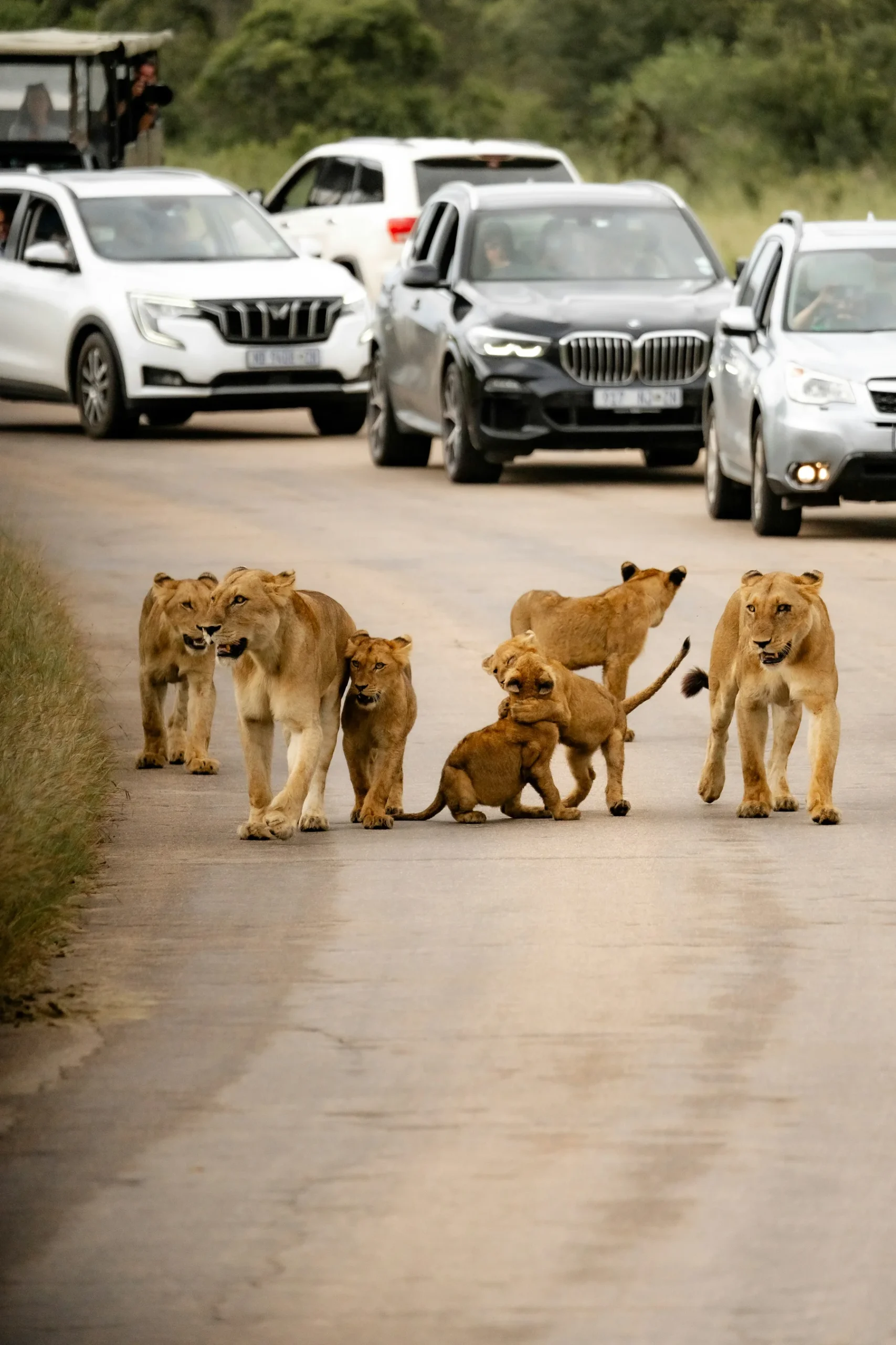
Inside the reserve, the road belongs to wildlife
The animal ahead is not blocking traffic. You are travelling through its habitat. Stop at a respectful distance, leave an escape path and follow the guide or ranger's instruction.
Do not crowd a sighting
Road congestion can trap animals and spoil the experience. The Masai Mara game-drive rules and wildlife etiquette guide explains positioning, noise, distance and vehicle limits.
Do not create a new track
Driving around mud or another vehicle can widen damage, crush vegetation and establish an illegal line that others follow. If the designated track is closed or unsafe, turn back.
Closed means closed
Land managers may close routes for erosion, flooding, bridge damage, restoration or wildlife. A closure is not an invitation to find an unmarked bypass.
Speed belongs to the setting
Slow travel protects wildlife, people, soil, passengers and the vehicle. It also makes sightings possible. The goal of a game drive is not to cover the maximum number of kilometres.
Give animals the exit
Never form a vehicle wall around a cat, elephant herd or crossing. Leave room for natural movement and avoid cutting off a mother from young.
Respect working communities on approach roads
Outside the protected area, roads pass homes, schools, livestock and pedestrians. Reduce speed, control dust near people and do not photograph residents without consent.
Photography from the road
Good positioning is patient positioning. The Masai Mara photography guide explains why a clear background and respectful angle are better than rushing close.
Game drives are not transfers
The Masai Mara game drives guide helps plan duration and pace. A vehicle racing from one camp to another is not giving guests a proper game drive or a calm transfer.
Internal-road behaviour table
| Situation | Poor response | Better response |
|---|---|---|
| Animal on the track | Rev, edge closer or surround it | Stop, lower voices and leave an exit |
| Mud ahead | Make a new line through grass | Turn back or follow ranger guidance |
| Closed sign | Drive around the sign | Use an approved alternative |
| Vehicle at a sighting | Block its view or squeeze past | Join calmly within local limits |
| Dust cloud | Follow closely | Increase distance and visibility |
| Pedestrians near a settlement | Pass fast | Slow down and reduce dust |
A practical pre-departure call
Contact the camp or planner one or two days before travel, then again on the morning if heavy rain has fallen. Ask for an update on the named road, gate and final camp track.
Ask what changed, not whether it is fine
“Is the road fine?” invites reassurance. Better questions are: Which section is slow? Has the camp changed its approach? Is a bridge open? Does a 4×4 need escort? What is the latest safe arrival?
Ask who drove it last
A report from a driver who used the route that morning is stronger than a general seasonal answer. Record the date and time of the update.
Ask for the alternative route
Every plan should have a decision point. If the preferred road is blocked, where should the driver turn and who authorises the alternative? Do not invent the alternative while parked at a flooded section.
Ask about gate payment and proof
Confirm whether entry is prepaid, paid at the gate or arranged by the camp. Carry identification, booking confirmations and required vehicle information in the accepted form.
Ask about arrival after the gate
The directions should continue all the way to reception. “Enter at Talek” is incomplete if the camp lies another hour through a complex track network.
Ask about a rendezvous
If the camp plans to meet your vehicle, agree on a visible fixed point and a time window. Share the registration number and keep the camp updated before signal drops.
Ask about luggage protection
Dust and rain can enter open or soft-sided luggage areas. Use closed bags and waterproof liners for electronics, medicine and clothing needed on arrival.
Ask about passengers
Tell the planner about children, pregnancy, motion sensitivity, mobility limitations or recent surgery. The right answer may be a different route, vehicle, stop plan or flight.
A message you can send your camp
“We are driving from [exact origin] on [date] in [vehicle]. Please confirm the recommended route, gate, dropped pin, current road condition, latest safe arrival, payment requirement, final camp track, escort point and alternative after rain.”
Camp-confirmation checklist
| Confirmation | Record |
|---|---|
| Exact property and GPS pin | Reception or meeting point, not a generic listing |
| Land unit | Reserve, Triangle, conservancy or private land |
| Gate | Full name and current operating status |
| Route | Towns, turns, bridges and approach |
| Vehicle | Minimum drivetrain, clearance and tyres |
| Weather | Date and time of latest road report |
| Timing | Departure and latest safe arrival |
| Contact | Primary and backup telephone numbers |
| Alternative | Decision point if the preferred route fails |
| Documents | Booking, permit, identification and payment method |

Vehicle preparation before Nairobi
Inspect tyres, spare, fluids, lights, wipers, battery, jack and recovery points. Do this before the departure morning, when replacing a tyre or fixing a wiper is still simple.
Tyres carry the route
Tread, sidewall condition and correct pressure matter on corrugation, stone and mud. The spare should be roadworthy, not merely present.
Clearance protects more than the bumper
Ruts and drainage humps can damage low components. Drive diagonally only when safe and permitted, and never use speed to jump a rough section.
Wipers matter in dust and rain
Worn blades turn a sudden shower into poor visibility. Washer fluid helps after dust, insects and mud coat the windscreen.
Lights are for visibility, not a night plan
Working lights help in cloud, dust and emergencies. They do not make a planned after-dark arrival appropriate.
Keep weight secure
Luggage can shift on rough roads. Heavy cases should be low and tied down. Nothing should become a projectile during sudden braking for an animal or rut.
Keep essentials accessible
Water, medication, rain layers, one warm layer, documents, phone cable and a small snack should not be buried beneath all luggage.
Protect the cabin from dust
Close bags, use pouches for lenses and keep a clean cloth for hands rather than wiping optics with dusty fabric. The photography guide explains a safer camera-cleaning routine.
Vehicle-preparation table
| Component | Check | Why it matters |
|---|---|---|
| Tyres | Tread, pressure, sidewalls and matching spare | Traction and puncture resilience |
| Jack and tools | Complete, accessible and tested | A spare is useless without safe fitting |
| Recovery points | Rated and identified | Prevents dangerous attachment |
| Wipers and washer | Working before departure | Visibility in rain, dust and mud |
| Fuel | Full with margin | Supply near the ecosystem is not guaranteed |
| Cooling and fluids | Inspected | Slow rough travel can expose weaknesses |
| Battery and charging | Reliable with phone power backup | Navigation and communication |
| Luggage restraint | Straps and weather protection | Passenger safety and dry essentials |
Packing for the drive
Wear comfortable layers and keep a light jacket accessible. The Mara can be cool in the morning even when the approach is hot and dusty.
Water without waste
Carry enough drinking water in refillable containers and secure it upright. Avoid leaving single-use bottles at stops or gates.
Food and wildlife do not mix
Eat only where permitted and never feed animals. Secure scraps. Habituated wildlife can become dangerous and may later be removed.
Medication belongs with the passenger
Keep essential medication in the cabin, not under luggage or in a separate transfer vehicle. Add a small margin for an unexpectedly slow arrival.
Motion sensitivity
Rough, winding and stop-start travel can trigger nausea. Discuss appropriate medicine with a healthcare professional before the trip, sit where movement is easier to manage and plan calm stops.
Children need a road day designed for them
Use proper restraints where compatible, bring quiet activities and plan toilet stops. Do not present the full day as a continuous game drive. There may be long transport sections with few animals.
Accessibility needs exact answers
Ask about step height, grab points, seat width, suspension, stop frequency and assistance. A generic “4×4” label tells you very little about boarding or comfort.
The arrival day should stay light
If the road day is long, avoid attaching a fixed sunset activity that creates pressure. A shower, meal and early night can be the better beginning.
What not to pack loose
Glass, open drinks, heavy camera bodies and hard cases should not move freely in the cabin. Secure them before the rough section begins, not after the first sudden stop.
The night before departure
Charge phones and cameras, download the map, save pins, check the weather, reconfirm pickup and place documents together. The quieter the departure morning, the easier it is to notice a missing instruction.
Route-choice examples
Examples are useful only when they show the decision process. They are not turn-by-turn directions and should never replace a current property instruction.
Example: eastern reserve camp
A Nairobi road safari to a camp near Sekenani may use the familiar Narok-to-eastern approach. The planner still confirms whether Sekenani is the correct gate, how the camp is reached after entry and whether the final track changed after rain.
Example: Talek-area camp
The route may head towards Talek, but the important detail is the camp's position relative to the river and bridge. The driver needs the correct bank and final turn, not merely the word Talek.
Example: Musiara camp
A northwestern camp may be better reached by a northern approach. Sending the vehicle to Sekenani first could turn arrival into an unnecessary cross-reserve transit.
Example: western Triangle property
The planner compares the Aitong and Oloololo approach with any route through Sekenani. The Triangle's own guidance supports the western approach for several properties on that side.
Example: reserve to Triangle split stay
The itinerary may intentionally cross at Purungat. The crossing becomes a planned transfer with permits, timing and a wildlife-aware pace, not an accidental correction for choosing the wrong external gate.
Example: conservancy stay
The guest follows the member camp's conservancy access instructions. Reserve gates are relevant only if a separate reserve visit is included. The booking defines access.
Example: heavy rain before arrival
The camp sends a new meeting point or alternative approach. The driver accepts the change, leaves earlier and avoids a vulnerable section. The old printed route remains in the glovebox, not in command.
Example: late flight arrival in Nairobi
A same-day road transfer may push the final approach towards darkness. An overnight near Nairobi followed by an early drive can be safer and more enjoyable than forcing the full distance.
Example: short two-night safari
The traveller compares a flight with a road day that uses much of the first and last day. The correct choice depends on budget, luggage, desired stops and the camp-airstrip transfer.
Example: Naivasha to the Mara
The route should be checked from the exact lodge in Naivasha, not copied from Nairobi directions. Road condition and branch choices differ, and a Nakuru reference in an old forum may not match the intended road.
Route examples compared
| Stay pattern | Likely planning focus | Decision that prevents wasted time |
|---|---|---|
| Eastern reserve | Correct eastern gate and final camp track | Do not assume every eastern camp uses Sekenani |
| Talek | River bank, bridge and local road | Confirm the full arrival pin |
| Musiara | Northern approach | Avoid an unnecessary cross-reserve arrival |
| Western Triangle | Aitong and Oloololo | Compare with Sekenani before departure |
| Split reserve and Triangle | Purungat crossing | Treat it as a planned transfer |
| Conservancy | Member-camp access | Match booking to conservancy gate |
If the route goes wrong
Stop somewhere safe before the uncertainty becomes a recovery. Do not keep driving deeper into an unverified track because turning around feels inconvenient.
If the pin and sign disagree
Follow official signs and call the camp. A pin can be old, misplaced or intended for another entrance. Do not cross a barrier or private track to satisfy the screen.
If you lose signal
Return to the last known point or follow the pre-agreed offline instruction. Random movement reduces the chance that camp staff can find you.
If you are late
Call early, not at the gate. The camp may arrange an escort, change the meeting point or advise an overnight alternative. Silence removes those options.
If rain begins hard
Reduce speed, increase distance and seek the camp's advice before reaching the weakest section. Do not wait until water is already crossing the road.
If another driver says it is passable
Ask when, in what vehicle and to which point. Their destination may turn before the hazard, and their risk tolerance may not match yours.
If you become stuck
Keep passengers away from moving vehicles, straps and unstable ground. Contact the camp or professional recovery help. Protect people first, then the vehicle and schedule.
If wildlife blocks the road
Wait quietly and maintain distance. Do not hoot, rev or leave the vehicle unless a ranger directs you. The animal chooses when the road reopens.
If a gate appears closed
Do not drive around it. Call the property or authority and use only an approved alternative. A gate may be closed for time, weather, security or management reasons.
If the bridge is out
Turn back to a safe place and obtain a confirmed detour. Do not attempt an informal water crossing or follow fresh tyre marks into the riverbed.
Incident response table
| Problem | First action | Avoid |
|---|---|---|
| Wrong track | Stop and contact camp | Continuing in hope |
| Lost signal | Use offline plan or return | Searching randomly |
| Heavy rain | Slow and reassess early | Racing to beat water |
| Stuck vehicle | Secure people and call help | Unsafe strap recovery |
| Animal on road | Wait at distance | Hooting or crowding |
| Closed gate | Call authority or camp | Bypassing the barrier |
| Damaged bridge | Turn back | Testing an informal crossing |
Frequently asked road questions
These answers are planning principles. Exact route condition, gate use and regulations must be confirmed for the travel date.
Is the road from Nairobi to the Masai Mara paved?
Much of the journey to Narok and portions beyond have paved sections, but the exact camp route may still include gravel, corrugation, dust, mud or wildlife tracks. Ask about each stage rather than expecting one surface from hotel to camp.
How long does Nairobi to the Mara take?
There is no honest single time for every property. Starting point, gate, stops, traffic, weather and final camp access all change it. Obtain a door-to-door plan for your exact accommodation.
Which is the main Masai Mara gate?
Sekenani is the best-known eastern gate, but “main” does not mean right for every camp. Talek, Musiara, Oloolaimutia, Oloololo and other access points serve different sides.
Which gate is best for the Mara Triangle?
Oloololo is the principal external western gate for many Triangle stays. Purungat connects from the reserve side. Some routes to Mara Serena may use Sekenani and cross internally, while western properties may be faster via Aitong and Oloololo.
Can I enter at one gate and leave at another?
It may be possible within an approved itinerary, but permits, hours, road condition and route restrictions apply. Confirm it rather than assuming all gates are interchangeable.
Do I need a four-wheel-drive vehicle?
A maintained 4×4 is the sensible standard for uncertain approaches and reserve conditions, especially after rain. Some dry routes may be easier, but a vehicle category alone does not guarantee tyres, clearance or driver skill.
Can a two-wheel-drive car reach the Mara?
It may reach some properties in dry conditions, but the final camp road or rain can change the answer quickly. Follow the property's current minimum vehicle requirement and do not stretch a rental beyond its terms.
Is self-driving allowed?
Self-driving can be possible under current entry and rental rules, but it demands route skill, suitable equipment and protected-area discipline. Confirm regulations and insurance for the exact vehicle and land unit.
What happens after rain?
Clay becomes slippery, ruts deepen, water hides damage and some tracks close. Conditions vary within kilometres, so request a report for the named approach and final camp section.
Should I fly during the rainy season?
Flying can avoid a difficult road approach, but weather can also affect flight and airstrip operations. Compare the entire transfer and keep flexibility in either plan.
Is the road safe at night?
Plan not to drive the rural approach or wildlife roads after dark. Visibility, livestock, pedestrians, wildlife, unlit vehicles and road damage make the risk unnecessary.
Can Google Maps choose the gate?
No. It may orient you, but it does not know the booking access, gate operation, private land rights or the camp's current rain route. Use camp-confirmed instructions.
Is Purungat an external arrival gate?
Purungat is mainly a connection between the central reserve side and the Mara Triangle. It should appear because the itinerary intentionally crosses there, not as an assumed Nairobi entry.
Can I drive directly from the Mara to the Serengeti?
Do not plan a direct tourist crossing through the protected-area boundary. Kenya and Tanzania immigration, vehicle and park rules require an authorised road or air connection.
How close should I follow another safari vehicle?
Leave enough space for dust to clear and for the vehicle ahead to brake for wildlife or ruts. Close following reduces visibility and creates pressure.
What should I do if the camp changes the route?
Confirm the new pin and instruction, save them offline and tell the driver. A recent local change should override an old printout or forum route.
What is the best source for current conditions?
A dated report from the exact camp, driver or land manager who used the route recently is strongest. Combine it with official gate and permit information.
A better Mara arrival
The best arrival is not the fastest line on a screen. It is the route that fits the property, gate, weather, vehicle and daylight with enough margin to stay calm when something changes.
Use this Masai Mara road conditions and which gate to use guide as a planning framework, then replace every general orientation with a dated instruction for your exact camp and travel day.
Let the landscape arrive gradually
On a road safari, the transition through the Rift Valley, Narok country and open plains can be part of the experience. There is no prize for turning it into a race.
Keep the first game drive honest
If arrival is later than planned, shorten or skip the drive. Wildlife will still be there in the morning. Fatigue and darkness should not decide the first hours of a safari.
Build one route, one alternative and one stop point
Know the preferred road, the approved backup and the point where you will stop to ask for help. That is more useful than saving five unverified routes.
Match every camp to its gate before payment
For a multi-camp itinerary, record the arrival and departure gate for each property. This exposes unnecessary crossings while there is still time to change the sequence.
Match every transfer to the day’s purpose
A road day, game-drive transfer and flight connection need different timing. Label the day honestly so the itinerary does not promise full wildlife time during a long relocation.
Final gate and road checklist
| Before leaving | Confirmed |
|---|---|
| Exact camp pin and land unit | Yes or no |
| Correct gate and current operation | Yes or no |
| Preferred route and approved alternative | Yes or no |
| Same-day weather and road update | Yes or no |
| Suitable maintained vehicle and spare | Yes or no |
| Daylight arrival margin | Yes or no |
| Fuel, water and medication | Yes or no |
| Offline directions and two contacts | Yes or no |
| Permit, booking proof and payment method | Yes or no |
| Passenger comfort and access needs | Yes or no |
Sources and further reading
- Masai Mara National Reserve Management Plan, Narok County Government.
- Driving to the Mara Triangle, Mara Triangle.
- Mara conservancies map, Maasai Mara Wildlife Conservancies Association.
- How to get to Mara North, Mara North Conservancy.
- Game-drive etiquette, Mara North Conservancy.
- Linked traveller discussions are used only for short dated personal experiences. They are not current road reports.
Let us match your stay to the right gate
Share dates, origin, accommodation, vehicle, passenger needs and planned stops. We will map a daylight route and an approved alternative for weather changes.